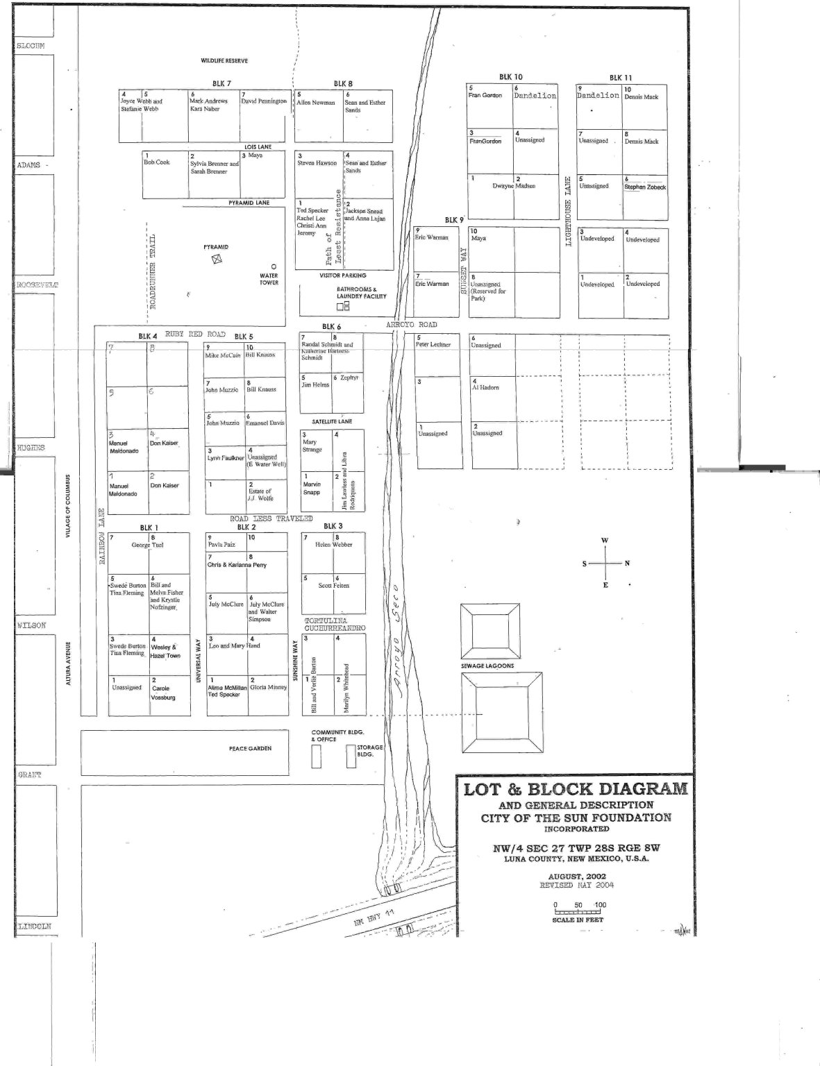
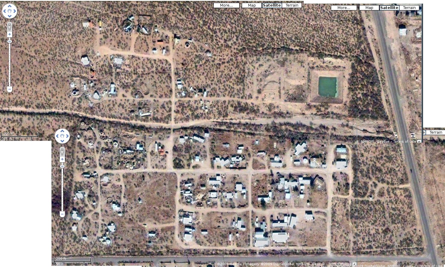
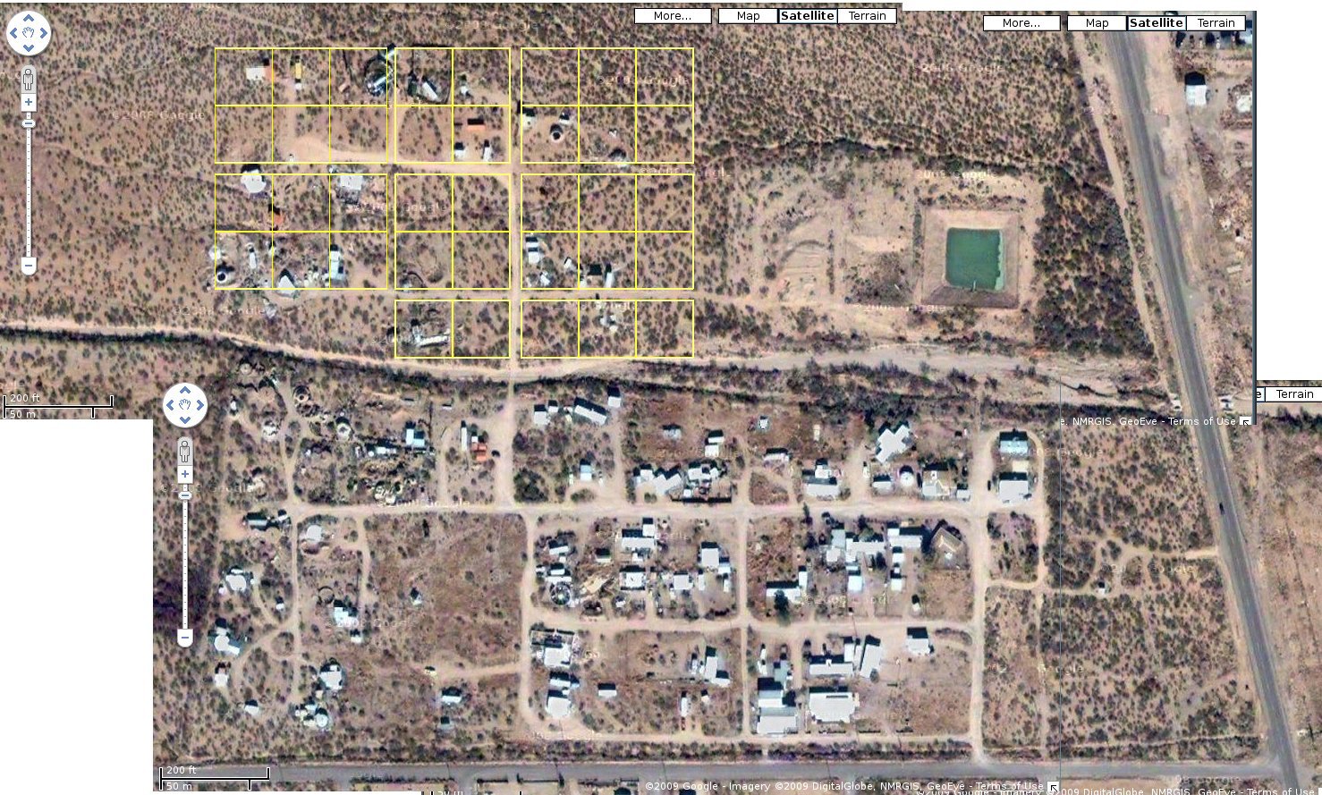
I've been playing around with Google satellite imagery, trying to do some "surveying" of the lots on the north side of the arroyo. It seems the scale shown on the satmaps is off; it shows 200 feet to 120 pixels, but my measurements don't agree. East-West measurements agree pretty closely, but North-South it's closer to 128 pixels, which makes a pretty big difference in how badly people on the north side are over their alloted space. Then there's the issue of ground distance vs. satellite imagery and "flat" maps like Alan's. Should the lots be measured as they appear from space, or from the ground?
No matter how you cut it, some people are over. here is my first attempt, not counting the one I made using a scan of Alan Newman's drawing earlier. This uses a Postscript program to generate the lines, using Alan's map as a guideline for road width. People running Mac OS/X, Linux or any Unix clone, or Cygwin on Windows can re-create this map using just the script, the Makefile, and the satellite image (which is 4 maps I "glued" into 1). You must have ImageMagick installed, or if you prefer GraphicsMagick, edit the Makefile and insert 'gm' in front of the 'convert' calls.
Anyway, getting back to that first plot. It's not going to sit well with most people; only Chris and Eric are wholly on their own lots, and Eric probably wouldn't want his house straddling two lots. So the next step would be to shift the Western lots over to the East a little, without affecting the East-side lots, which are already awfully close to Arroyo Road (Paul is even into it a little in this approximation). So this code shrinks Arroyo Road to a 20-foot road the same as Sunset Way, and shifts everything over to match, which helps Eric and Adelaide, and doesn't hurt anyone except Fran, who already paid for her overage (as Eric also did long ago, as I understand).
Now, we can pretty much eliminate both Adelaide's and Gordon's overage by shrinking Lighthouse Lane to 20 feet. This also helps Paul somewhat, and doesn't hurt anybody else; except that now the unoccupied lots across from me are now short because the road cuts through them.
So, making a lot of assumptions -- that the satellite data is correctly aligned and consistent in size -- that I now have the correct mapping between pixels and feet -- that COS lots were indeed intended to go straight East-West -- that, if those assumptions are all true, then at least Steve, Paul, Maya, myself (jc), and Patricia are all into roads and/or adjoining properties. The question is, then, what if anything are we going to do about it?
The current date is Sunday, 26-Jul-2026 00:21:43 EDT
This page was last modified Friday, 06-Mar-2009 13:38:19 EST
Author: John Comeau <jc.unternet.net> (change the first dot to @)